Posted in History & Literature

Lo Stivale

The Italian peninsula is nicknamed “Lo Stivale” (“the boot”) because of its iconic geography. Every child who has ever seen a world map will know this iconic boot-shaped country.

But hypothetically speaking, if Italy was actually a giant boot, what shoe size would you have to be to fit it?

Shoe sizing varies across the world. In Korea, Japan and Taiwan, the Mondopoint system is used where the foot length is measured in millimetres (the width is also considered).

But if you come from an English-speaking country, there is a good chance you are more familiar with the UK and US number system, typically ranging from 3 to 13.

The UK sizing system uses the length of the last that is used to make the shoe. A last is a model of a foot that can fill the entire cavity of the shoe. Because you typically need 1-1.5cm wiggle room for your toes, the last is bigger than the foot that would eventually wear the shoe. Instead of simply using the length of the last in millimetres, UK shoe sizes use a strange unit called the barleycorn.

The barleycorn originates from the 19th century when an inch was defined as the length of three barley corns (or grains). Hence, a barleycorn is ⅓ inch. For adult shoe sizes, a size 1 is 26 barleycorns, or 8 and 2/3 inches (220mm). For every size you go up, you add one barleycorn. This means a size 11 is 12 inches, while a size 10 is 11 and ⅔ inches.

Essentially, this means that your UK shoe size is:

(3 x heel-toe length of your foot in inches) – 23 (accounting for the toe wiggle room).

It is important to note that every manufacturer takes their own liberty with sizing, so this will often be inconsistent and can vary up to an inch, especially for women’s shoes. The US system starts counting at 1 instead of 0, meaning that you just add 1 to the equivalent UK size.

Now that we know how sizes work, let us size the Italian boot.

By rough estimate, the “sole” of the peninsula is approximately 360km long. This is accounting for the bend in the middle, as the heel height is tall. To use our formula, we must convert this into inches, which equals 14,173,200 inches.

Ergo, the shoe size calculates as follows:

= (3 x 14,173,200) – 23
= 42,519,577

Whether you use the UK or US sizing, the boot is roughly a size 42.5 million. Or, if you live in Korea, the shoe size would be recorded as 360 million. Either way, that is one big shoe to fill.

Posted in History & Literature

Maps

Think of the world map. Most of you will think of the typical map where Europe and Africa are in the middle, with Russia dominating the Eurasian landmass and Greenland easily outsizing South America.

Mercator projection

The most common world map we use nowadays is based on the Mercator projection. Because the Earth is spherical and maps are two-dimensional rectangles, complex mathematics are involved to project the former on the latter by distorting the picture. The Mercator projection was created by Flemish cartographer Gerardus Mercator in 1569. The map was extremely useful for sailors because it depicted the curvature of the Earth in straight lines, making navigation much easier.

However, the Mercator projection severely distorts the size of each continents, meaning the image of the world we have in our heads is completely misleading. According to the Mercator projection, Greenland is as large as Africa, Alaska is as large as continental USA and Antarctica dwarfs every continent.

Gall-Peters projection

To solve this problem, the Gall-Peters projection was suggested in 1974 as an alternative as it correctly displayed the continents’ respective sizes. As you can see, in reality Greenland is significantly smaller than even Australia, Europe and Russia are much smaller than expected and Africa is an extremely large continent.

Dr. Arno Peters argued that the Mercator projection was a biased, euro-centric projection that harmed the world’s perception of developing countries. This of course, led to extreme controversy over the politics of cartography.

Africa vs Greenland

There are many other distortions commonly found in maps. Maps tend to enlarge the landmass of the own country subtly and some American maps go as far as placing the USA in the middle even if it means splitting Eurasia in half. Even though landmass does not correlate in any way with how well the lives of its inhabitants are, such distortions can be seen even nowadays. This shows that not everything you see is as it seems.

Posted in History & Literature

Direction

Most of mankind’s major expeditions happened from east to west. Since the beginning of man’s history, people have wondered where the giant fireball set at the end of the day and followed the journey of the sun. Odysseus, Christopher Columbus and Attila the Hun all believed the answer lied in the west. To journey to the west – that was a quest to know the future.

Contrary to the people who questioned where the sun was heading towards, there were also people who wondered where the sun came from. Marco Polo, Napoleon and Bilbo Baggins (protagonist of The Hobbit By J.R.R. Tolkien) are examples of people who travelled to the east. They believed that they would surely discover great things in the place where everything originated from.

In the symbolic system of adventure, there are still two directions left for travellers. The meanings of each are as follows: to venture north is to seek obstacles that can test your abilities, while journeying to the south is seeking rest and peace.

image

(from The Encyclopaedia of Relative and Absolute Knowledge by Bernard Werber)

Posted in History & Literature

Surname

There is an interesting story regarding the history of Japanese surnames – known to be the most numerous in the world as there are over 100,000 surnames in Japan.
It is said that in the late Sengoku period (16th~17th century), a period filled with civil wars, there were so many soldiers who had died that there was a shortage of men. To remedy this, Toyotomi Hideyoshi (who unified the clans in Japan) issued a ruling to all women, stating they must wear a blanket-like cloth on their back and to wear no underwear. If they met a man, they were obligated to have intercourse with them in the hopes of conception. This is the origin of the kimono – a garment that can easily be undone and be used as a blanket outside when required (although now the use is different), and the reason why underwear is not worn with kimono traditionally.

This meant that any surviving males had the luck of having any women they pleased. This resulted in the women not knowing who the father of the baby was and thus they named their babies according to where they were conceived. Out of all Japanese surnames, 80% refer to something geographical: 山本 (yamamoto) – at the mountain, 木下(kinoshita) – under a tree, 竹田 (takeda) – at the bamboo field, 山野(yamano) – mountain plain, 川邊 (kawabe) – next to a stream… and the list goes on.

With their surnames being so ranged and “meaningless”, culturally Japan is not very attached to their own surnames. Contrary to this, the neighbouring countries, Korea and China, place great importance in surnames as it shows the roots of the people. For example, in Korea all families have a book called jokbo where the entire family lineage for the surname can be traced back to the root. Every family member’s name and birth date is recorded along with the generation they are in.
Because of this, the Japanese were perplexed after their invasion why the people were so against changing their names to Japanese. What they did not understand was the pride people have in their names and their cultural heritage, as the same pride is not found in Japan.

Posted in History & Literature

Dokdo

Dokdo is a small island in the East Sea off the coast of Korea, lying at 131°52´East longitude and about 37°14´North latitude. It literally means “solitary island” in Korean due to its rocky, isolated nature. The island is actually in two parts: West Island and East Island, which are connected by an underground rock formation. 
The island has been Korean territory for two millennia, with records going back as far as the 4th century showing that fishers from Ulleungdo (a much larger island also in the East Sea) documented the existence of the island and fished around the area. The island is also visible from Ulleungdo on a clear day so it would have been easily spotted and recorded.

Despite the incontestable evidence, in the last few decades Japan has been arguing that Dokdo is Japanese territory. The Japanese government denies the current evidence and claims that all evidence is faked. However, the claims made by Japan are extremely obtuse and bearing on childish. There are many reasons they seek control over Dokdo, such as the rich fishing area around it, the abundant hydrocarbon reserve underneath it and also rearing the ugly head of colonialism.

Almost all historical records and maps up to the 19th century clearly indicate the island as “Korean territory”. For example, in Map of Three Adjoining countries by Hayashi Shihei, a Japanese scholar and cartographer, shows the land in the Far east divided in to colours: yellow for Joseon (Korea) and green for Japan. It is one of the earliest complete maps of Japan. Here, the islands east of Korea, including a large island clearly marked “Ulleungdo” and many surrounding small islands, are all marked yellow and labelled “Korean territories”. There are also records of the Shogunate querying the Tottori clan (who controlled the Shimane prefecture at the time) whether Dokdo and Ulleungdo were Japanese islands, to which the Tottori reply “No, those islands have never been under Japanese rule”. Finally, legal documents by the Japanese National Land Registry in 1877 state that Ulleungdo and Dokdo are not under Japanese rule.

Things became complicated in the early 20th century with the Japanese invasion of Korea. Starting from this period, Japanese maps began marking Dokdo (and Korea and Taiwan and all other colonies) as “Japanese territory” after invading each land. But after their defeat in World War II, Japan was forced to return all land that they stole in the war as ordered by the Treaty of San Francisco. This treaty outlined what the new definition for “Japan” would be by drawing their border again. This treaty states that “Japan is defined to include the four main islands of Japan and the approximately 1,000 smaller adjacent islands, including the Tsushima Islands and the Ryukyu (Nansei) Islands north of 30° North Latitude (excluding Kuchinoshima Island); and excluding (a) Utsuryo (Ulleung) Island, Liancourt Rocks (Dokdo) and Kuelpart (Jeju) Island…”.
After the Korean War, the UN set a zone called the Korean Air Defence Identification Zone (KADIZ) to mark the areas to be protected by the air force. The KADIZ also includes Dokdo in its boundaries.

There are hundreds of pieces of evidence that support the rightful ownership of Dokdo as Korean land, yet Japan continues to argue in an attempt to bring back its old habits of colonialism. It is sad to think that after the Colonialism times and the Pacific War, where so many innocent people were sacrificed to fill the greed of a corrupt country, Japan has not learnt a single lesson.

In short, the controversy around Dokdo is essentially the same as someone claiming that your finger belongs to them and arguing that you should go to court to prove that you own it. 

Posted in History & Literature

Population

The following is a list, based on 2011 standards (world population 6.9 billion), of the most populous countries in the world:

  1. China (1.3 billion)
  2. India (1.2 billion)
  3. United States of America (311 million)
  4. Indonesia (238 million)
  5. Brazil (191 million)
  6. Pakistan (176 million)
  7. Nigeria (158 million)
  8. Bangladesh (151 million)
  9. Russia (143 million)
  10. Japan (128 million)

Posted in History & Literature

Pakistan

Pakistan is a country founded in 1933 and is located west of India and China. It formed from the unification of some of the upper regions of India, where the ruling power of Britain had weakened from Gandhi’s independence movements (in fact, Pakistan was still under British rule until 1947 when it gained independence). The people in this area were mostly Muslim and Pakistan was formed amid fears that the Muslim would be neglected in politics by Hindus.

The etymology of the country’s name is quite peculiar. Pakistan is an acronym of the five regions that formed it: Punjab (P), Afghan (A), Kashmir (K), Sind (S), and Baluchistan (TAN), combined with I for Islam. Also, the word “Pakistan” is a portmanteau of Pak, which means “clean/pure” in Hindustani, and –stan, which stands for a country in Turkish.

Interestingly, the word Pakistan was devised by British students at Cambridge University.

Posted in Science & Nature

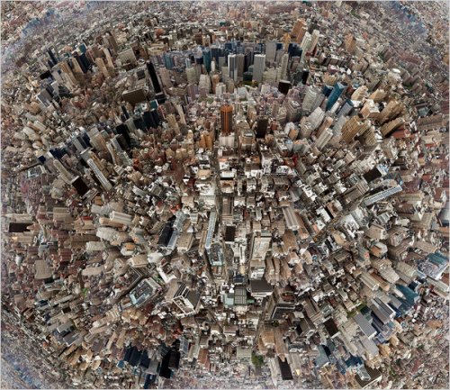
Urban Paradox

A few years ago, a theoretical physicist studied population growth in cities to find the mechanism of how cities operate. What he found was an astonishing law.
Wherever the city, as the population doubled in size, the average income, number of patents, number of educational and research facilities and other important numbers all increased around 15 percent. Although it is normal for such statistics to increase as a city grows, it is interesting to see that almost all of them increasing at a similar rate, despite being so different sometimes.
More fascinating is the fact that not only do the above “good” statistics increase equally, but so do crime rates, pollution, smog occurrence, stomach flu and AIDS prevalence all increase approximately 15 percent.
Therefore, a city can be seen as a double-edge sword that is both the source of fast growth, wealth and ideas, but also waste, pollution, stress and disease.

Biologically speaking, an organism has a tendency to have slower growth and pace of life as it gets larger. For instance, an elephant’s heart beats slower than a mouse, and its cells do less work on average too. However, a city exhibits a snowball effect where it grows faster as it gets larger. To achieve this extremely high rate of growth, it must consume an immense amount of resources, which ultimately ends up as large quantities of waste and pollution. Also, as people get busier, the overall “quality” of the society falls, leading to increased stress and disease prevalence.

If so, should we abandon our current productivity and live a slow, village life and ignore our potential as a species? Or should we continue our exponential growth at the cost of using up nature’s well-maintained resources like no tomorrow?